Writer: Jake Breen
Date: June 15th, 2024

Article Title:
Extreme sea levels, coastal flooding and climate change with a focus on Atlantic Canada
Article Affiliation:
Department of Oceanography, Dalhousie University, Halifax, NS, Canada.
Article Citation:
Thompson, K. R., Bernier, N. B., & Chan, P. (2009). Extreme sea levels, coastal flooding and climate change with a focus on Atlantic Canada. Natural hazards, 51, 139-150.
INTRODUCTION
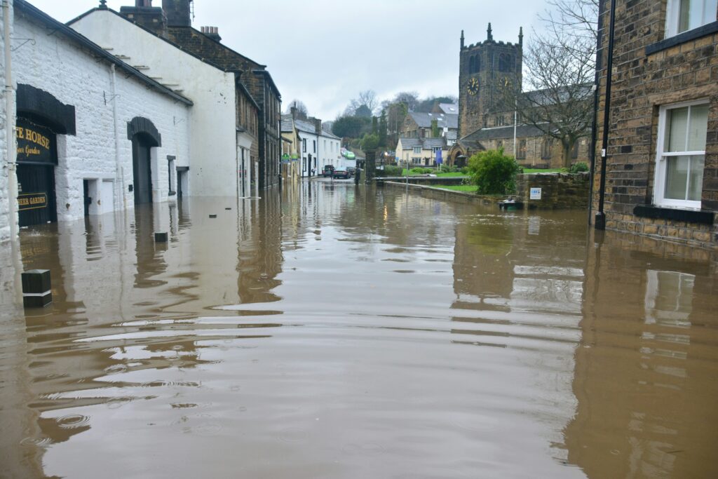
One of the major consequences of climate change is that sea levels across the globe are rising. The increase in global temperatures through global warming contributes to thermal expansion (water expands when it is warmed) and the melting of ice, which both directly increase local sea levels. A variety of other problems arise as sea levels increase, including coastal flooding, which is an abrupt increase in water levels leading to erosion, loss of property, and loss of lives.
The research presented in the article Extreme sea levels, coastal flooding and climate change with a focus on Atlantic Canada looks at sea levels and coastal flooding in Atlantic Canada. The authors aim to review and develop new methods to determine the chances that flooding will occur in certain coastal areas. Although other methods exist that accomplish similar goals (ref), these classical methods are limited in their description of how climate change will impact coastal flooding. The study at hand reviews two methods that predict the probability of coastal flooding. The first method is based on computational dynamic modeling, whereas the second method is based on statistical analysis of observed sea level records.
RESULTS AND DISCUSSION
The dynamic modeling method was used to estimate extreme sea levels in Atlantic Canada, using data from 1960 – 1999, and the results closely agreed with observed sea levels. Using this model, the researchers identified flooding hotspots across Atlantic Canada. The statistical method was also used to calculate the probability that sea levels would exceed a certain value, corresponding to a period of flooding. This method was compared with observed sea level data over a 10 – year period, and also showed good agreement. Due to the nature of this second method, flooding hotspots were not able to be identified. Instead, this method produced data in the form of return periods, which is the average number of years between floods.
The results show that each method has a variety of strengths and limitations in predicting sea levels. The statistical method was found to be beneficial in its ability to answer questions about how climate change can impact the frequency of flooding. However, this method was limited in its ability to directly study sea levels and how they are impacted by climate change. The dynamic modeling method was beneficial in its ability to complete spatial modeling over Atlantic Canada, and therefore identifying flooding hotspots. The data provided from this method also addresses questions about how climate change can impact both the frequency of flooding and local sea levels. However, this method is still limited in its ability to predict future sea levels. Generally speaking, the researchers suggest the quality of predictions by any method is totally dependent on observations from the past, which does not necessarily guarantee accurate future predictions.
Coastal flooding is a serious issue that can negatively impact individuals living in coastal areas. The research presented in this study allows scientists to predict which coastal areas are vulnerable to extreme sea level rise and coastal flooding events as climate change continues to progress. Although coastal flooding cannot be prevented, these predictions can inform the development and awareness of enhanced safety measures for communities in vulnerable areas.
CONCLUSION
In conclusion, the research discussed in this article presents new ideas and methods which allow the prediction of sea levels and coastal flooding across Atlantic Canada. These new methods show advances in the ability to consider climate change impacts on the frequency and intensity of coastal flooding events. The methods were subsequently used to identify flooding hotspots in Atlantic Canada. This research is especially important to Atlantic Canadians as it provides information about which areas across the Northeast Atlantic are most vulnerable to flooding.